 |
|
EXPERIENCING THE GOLDEN GATE BRIDGE |
|||
The Under-a-Bridge Story |
|||
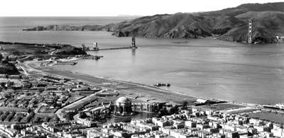
Story and photos by Lee Juillerat Historic photos courtesy of Golden Gate National Recreation Area, Park Archives |
Every day thousands of people drive across the iconic Golden Gate Bridge. When I lived in the San Francisco Bay Area, and in the years since when I’ve visited, I’ve been one of those drivers or passengers who has oohed and aahed at the stupendous views from the Bridge.
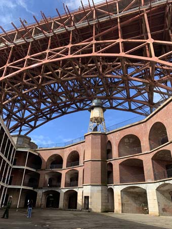
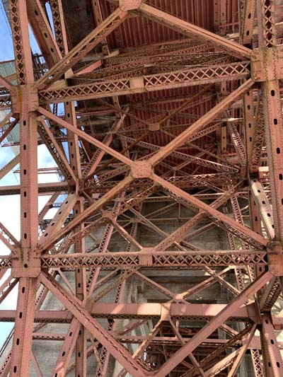
Views of the underside of the Golden Gate Bridge at Fort Point
On a recent San Francisco visit I saw the Golden Gate from a different perspective – from underneath. The new view led to new thoughts. The result is this under-a-bridged version of the Golden Gate Bridge. But before the under-a-bridged version, I’ll toss out a few – make that several – Bridge factoids.
When it opened for public use on May 27, 1937, the Golden Gate Bridge was touted as one of the “Wonders of the Modern World.” At the time it was the world’s longest and tallest suspension bridge, with a main span of 4,200 feet and a total height of 746 feet above the water. (It’s still the tallest bridge in the nation.) The cost for building the Bridge, $36 million, was provided through tax-free municipal bonds.
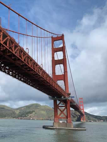
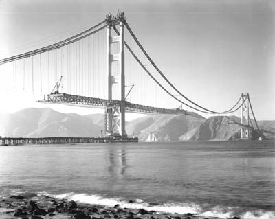
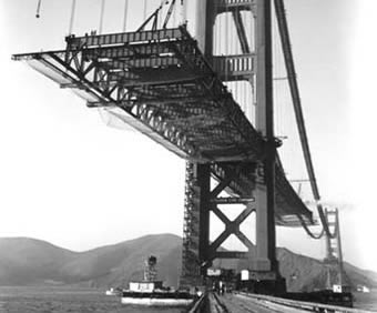
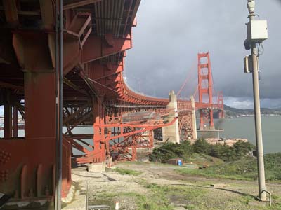
Two views of the Bridge without a roadway
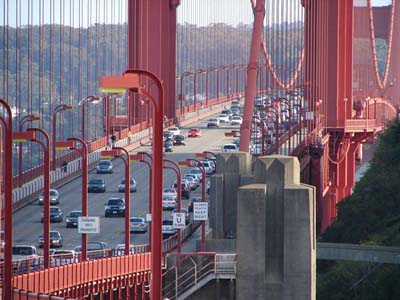
The Golden Gate Bridge is visually beautiful – and busy. On an average day it’s estimated that about 110,000 vehicles cross the 8,981 feet, or 1.7 miles Bridge. More stats - the length of the suspension span is 6,450 feet, 1.22 miles and is 90 feet wide, with the roadway measuring 62-feet.
A timeless symbol of San Francisco, the Bridge stands out because of its iconic orange-red towers - touted as “International Orange” - that rise high above San Francisco Bay. While it’s mostly traveled by daily commuters, others walk or bicycle across on its pedestrian pathways. People heading into the city get peeks of San Francisco’s skyline while those on their way to Marin County are treated to sights of the Marin highlands. Special times happen when fog rolls into the Bay from the Pacific Ocean. The mist often curls around the Bridge’s towers, creating a fuzzy haze over San Francisco or, sometimes, totally obscuring all views. No matter the conditions, cars, trucks and all sorts of vehicles work their way across, with three lanes in each direction.
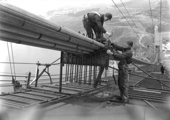
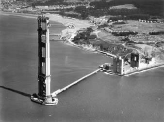
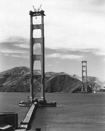
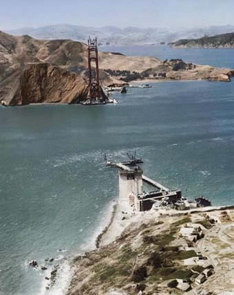
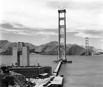
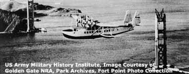
Two views while still under construction in 1935
The Bridge is a longtime landmark and, because it’s a gotta-see-it destination for tourists, it lures visitors to its viewing points at both ends. History talks are offered on Thursdays and Sundays during free walking bridge tours provided by San Francisco City Guides.
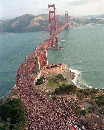
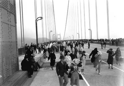
Both ends of the Bridge connect with the Golden Gate National Recreation Area, one of the world’s largest urban area national parks that features several trails and viewpoints. Also, be sure to check out the new Golden Gate and Pacific Overlooks near the Bridge. It’s believed the largest turnout of walkers happened in 1987, when an estimated 800,000 people gathered to celebrate the Bridge’s 50th anniversary, dubbed Bridgewalk 87. The weight of the massive crowd reportedly caused the Bridge to sag 7 feet. Although the mob caused the Bridge to flatten from its usual convex shape, an engineer, Daniel E. Mohn, reaffirmed it was not overstressed.
While Bridge travelers are usually ready for the wind and fog, for many the biggest surprise is often the noisy traffic. That’s because Highway 101, which is also Highway 1 in this section, crosses the Bridge with those routinely high volumes of vehicles. According to the Bridge’s website, “The steel framework under the modern lightweight roadbed amplifies the traffic noise and there are loud whining and clackety-clack sounds as cars and trucks pass over the bridge’s expansion joints. These joints allow the roadway to expand and contract with the extreme high and low temperatures the bridge endures, all without buckling or cracking the deck.” Yes, the sound of passing vehicles is noisy, but the views from the Bridge make it worthwhile. Walkers and bikers are encouraged, but there are restrictions. Dogs are not allowed to walk across because of the high density of bikes and pedestrians. Likewise, skateboards, skates, roller blades, wagons, wheelbarrows and anything else with wheels except bicycles are prohibited. Sidewalk access hours during Daylight Savings Time are 5 a.m. to 9 p.m. while sidewalk access hours during Standard Time are 5 a.m. to 6:30 p.m. Automatic gates open and close at those times so the schedule is precise. Bike riders have overnight access on the west sidewalk but have to ring a buzzer for security to admit them through each security gate.
All pedestrians use the east sidewalk, which faces San Francisco and the Bay. On weekdays bikes can use this route before 3:30 p.m. On weekdays before 3:30 p.m. the west side walkway, which faces the ocean, is usually reserved for maintenance crews. After 3:30 and weekends it’s reserved for bike riders.
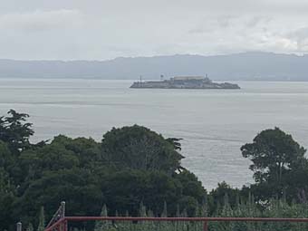
There are view areas on both sides of the Bridge’s northern and southern ends. Two passageways beneath the Bridge deck near the parking lots - a broad tunnel at the south end and a narrow passage at the north end - give walkers and bike riders the chance to cross between the two sidewalks, providing access for photos on both the eastern and western sides of both ends of the Bridge. Highlights of walking or pausing along the Bridge include views of San Francisco, Alcatraz, Angel Island, the Marin Headlands, Tiburon and the East Bay. At mid-span the gigantic cables come down to the level of the deck, allowing you to see just how thick they are. The South Tower, or San Francisco side, has a plaque commemorating the engineers and politicians who managed the Bridge’s construction. On the south end below the Bridge on a promontory is the old Fort Point, which is a National Historic Site. On the north end below the Bridge is the pier from the old Fort Baker.
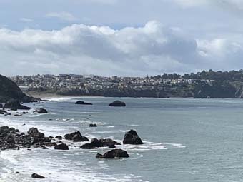
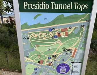
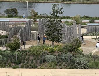
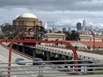
So, what about the under-a-bridge version? Over a several-day period, my wife and I explored sections of the Golden Gate National Recreation Area, hiking and driving at a series of locations on the San Francisco side of the Bridge, including the Presidio Tunnel Tops. From different vantages we saw glimpses of downtown’s towering buildings.
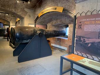
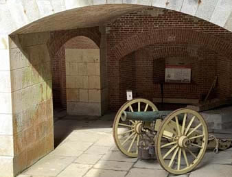
A pair of Fort Point cannons
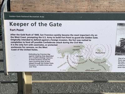
On one of those outings we drove to the Fort Point National Historic Site. Indeed, Fort Point has a history. The masonry seacoast fortification was built on the south side entrance to San Francisco Bay. At one time the Fort had 126 cannons, each weighing 10,000 pounds, to defend from possible invaders. Known as “the Gibraltar of the West Coast,” it was constructed between 1853 and 1861 during the California Gold Rush as “the most formidable deterrence America could offer to a naval attack on California.”
What makes Fort Point interesting is its “Third System” style of military architecture, with the Fort being the only one west of the Mississippi River. Although Fort Point never was used in battle, it and neighboring fortifications were intended to protect from an attack from sea during the Civil War and World Wars I and II, with soldiers stationed in case of an attack by submarines.
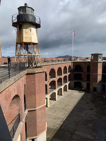
Lots to see at Fort Point inside and out
Because of plans to build the Golden Gate Bridge in the late 1930s, there were plans to demolish Fort Point. But because of its architectural value, a special arch was created that allowed Bridge construction over the Fort. In 1959, retired military officers and civilian engineers created the Fort Rock Museum Association and lobbied for its creation as a National Historic Site, which happened in October 1970. Fort Point is a treasure to experience. Easy paths weave and meander around and through the Fort with interpretative displays providing glimpses into its history. The Sally Port features an entrance built to limit enemy access and strengthen defense capabilities. Imagine soldiers standing guard atop elevated posts. Displays at other areas, including Magazine 1 and 2, tell about the Fort’s importance and the people who built, lived and worked at the Fort. Wanderings are rewarded with openings that expose the Bay, feature examples of those massive cannons, and provide information on its history.
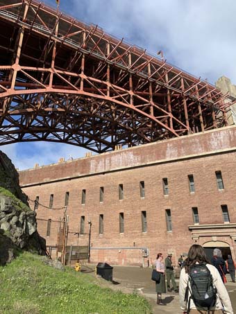
But the Fort also offers views of the underside of the Golden Gate Bridge. It towers overhead, its skeletal array of support beams at times framing the Fort and its arched walls. In some places the Bridge’s underside appears like a massive, complex spiderweb of steel, an orange jigsaw puzzle created by engineers to support its never-ending traffic.
From the underside of the Bridge, its gracious curves are visible along with a white circle around its base, a concrete barrier that now deflects the powerful tidal currents, protects against ships that get off course, and provided a foundation for a tower during the Bridge’s construction. Even more is sense of awe in appreciating the scale of the Bridge. There’s also the revelation of the vast expanse of water and sky. Yes, the view from Fort Point indeed provides an insightful, under-a-bridged appreciation of the Golden Gate Bridge. And the obligatory gift shop provides lots of good temptation.
For more information on the Golden Gate National Recreation Area visit the website at https://www.nps.gov/goga/siteindex.htm. Hours for biking and pedestrian travel are subject to change, so check before you go. Information about Fort Point is available at www.nps.gov/fopo/exhibit.htm. Historic photos used with this story are credited to Golden Gate National Recreation Area, Park Archives while other images were taken by Lee Juillerat. About the Author
|