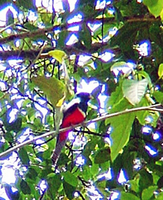
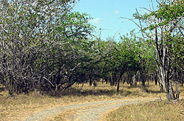
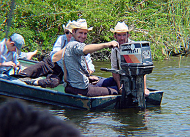
I tried to emulate my target: stealthy and focused, intensely acute to all sound and movement around me. But as I stalked the tropical rainforest of Cockscomb Basin, howler monkeys bellowed at me from their perches, birds flitted about in the tropical hardwoods, and with every step I struggled to avoid being snared in the vines criss-crossing my path. I heard rustling in the undergrowth, and although I knew he was nocturnal, I still hoped to catch a glimpse of the king of American jungles.
I was sad to leave the western fringes of the Maya Mountains with all its wonders (see Belize Part 1:The Western Frontier in the June-July 2007 issue of HighOnAdventure), but hoped a cooling breeze off the Caribbean would take the edge off the early season heat and humidity.
Heading east on the Western Highway, we turned south at Roaring Creek onto the Hummingbird Highway and proceeded toward Belmopan. After Hurricane Hattie almost destroyed Belize City in the early 1960s, a modern capital was whittled out of the jungle in the middle of the country, near the eastern foothills of the Maya Mountains. This new center of government was christened Belmopan, combining “Bel” from Belize and “mopan” from the Mopan River. Planned as an administrative center, it is a rather uninspiring settlement that doesn’t hold much draw for visitors.
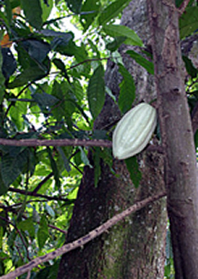
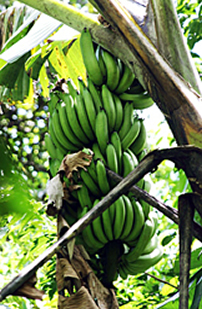
So onward we went, past Good Living Camp and Over-the-Top Camp, crossing a number of rivers flowing out of the Maya Mountains, past plantations of citrus, bananas and cacao, finally arriving where the Southern Highway segues from the Coastal Highway. That evening we would head up the Northern Highway, at which point we would have driven every highway in the country in one day.
Did I mention there aren’t a lot of paved roads in Belize?
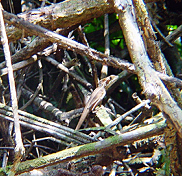
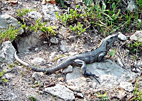
I had come to Cockscomb Basin Wildlife Sanctuary and Jaguar Preserve with the aspiration of finally seeing a jaguar in the wild. Believed by the Maya to be the communicator between the living and the dead, a sizable population of these beautiful felines led to this area being set aside as the world’s first jaguar preserve. A skittering in the undergrowth was only a Jesus Christ lizard. A loud thump nearby proved to be a toucan dropping some of the fruit he was lunching upon.
It was odd, even with all the critters that populate this Sanctuary, sounds were so muffled. There was a possibility of seeing pumas, ocelots, margays, mountain lions, agoutis, jaguarondis, otter, brocket deer, peccaries, anteaters, armadillos, tapirs, coatimundis, kinkajous and a half-dozen other mammals. Combined with more than 290 species of birds, it’s no wonder this area was established as a forest preserve in 1984.
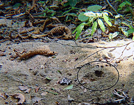
Finally my guide excitedly waved me over to a small stream of water, and there in the sand were three fresh paw prints of my quarry. Alas, we had missed him, but it was reassuring to know they did exist among the earthy and rich rainforest surrounding us.
the "take" is fairly obvious
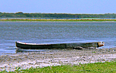
A dugout canoe awaits the rainy season on the banks Cashew orchards are an important crop to Crooked Tree villagers
of Crooked Tree’s Northern Lagoon
Crooked Tree Village
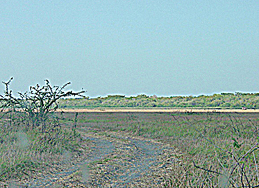
Aiming the headlights toward the Northern Highway and the border with Mexico, we skirted through the undistinguished town of Belize City and continued about another 30 miles northwest. Once a seabed, northern Belize is a vast array of wetlands including lagoons, marshes, swamps and estuaries. On an island inside 16,400-acre Crooked Tree Wildlife Sanctuary, on the banks of the Northern Lagoon, sits Crooked Tree Village. Inhabited by a handful of families, the Village was once accessible only by boat, but a bridge now spans the waterway. It was the end of the dry season and looked as though you could wade across, were it not for the crocodiles lazing away on the sandy banks.
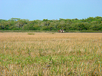
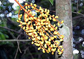
Regarded as a paradise for birdwatchers and naturalists, you could fritter away many hours watching egrets, herons, ibis, Jabiru storks, ospreys, kingfishers, hawks, spoonbills and countless other species of water birds who consider Crooked Tree their own 24-hour supermarket. The avian guests are only outnumbered by the cashew trees which engulf the Village. I’d never seen one before, and was amazed at the bright yellow orb with its single nut curving out the bottom.
The Village was established over 300 years ago during the heyday of logwood extraction, a tree used to make dye and which was greatly in demand by Europeans. The Village covers about 2.5 square miles of the 20-square-mile island. Its inhabitants are mostly fishermen, cattle ranchers and cashew farmers. The island is surrounded by the Sanctuary and its network of lagoons and wetlands, which includes the largest continuous stand of logwood in the country.
Home to some of the earliest Maya settlements, archaeologists have found traces of communities in this area of Belize dating as far back as 2000 BCE. While mighty cities like Caracol, Xunantunich and Lamanai waged war and made alliances with their powerful neighbors, numerous small agricultural settlements dotted the landscape. At their peak, one to two million Maya are estimated to have lived in what is now Belize.
In my research, I had come across a relatively unknown site near Crooked Tree. The existence of Chau Hiix (cho HEECH) had long been known by locals, but was kept a secret for fear of looting. Finally in 1989 Villagers revealed it to a cultural anthropologist working in the area. Even most of the Mesoamerican guides I spoke with were unaware of Chau Hiix, so of course I HAD to visit it.
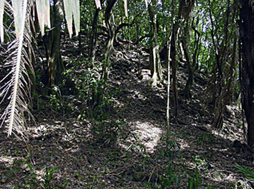
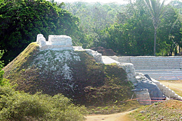
In the dry season, the Western Lagoon on the other side of Crooked Tree Village completely dries up. We drove past the small clusters of houses, through the cashew orchards, right down into the Lagoon, and headed towards a large hump on the southwestern horizon. This “hump” turned out to be Structure 1 cloaked in nearly 500 years of vegetation. The only hint of life was a caretaker busy mending his fishing nets, who took little notice of our presence. Even his two dogs seemed more content to lie in the shade of a cohune palm than inspect trespassers into their refuge.
From the West Lagoon, 75-foot tall Structure 1 appears Excavations have shown Structure 1 consists of ten layers as a massive forest-covered mound constructed over a thousand-year period
Settled around 1100 BCE and inhabited until about 1650 CE, the exact size of Chau Hiix is unknown but covers at least six square miles. Limited excavating is done every other year, and the work carefully closed at the end of each dig season to prevent deterioration or looting. There is evidence of palaces, pyramids, plazas and a ballcourt. A network of hydro systems - canals and dams - is extensive enough to be seen on satellite images.
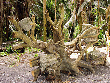
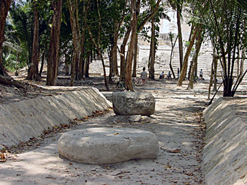
I gazed in awe at a large tree uprooted by a hurricane in 2000. Toppled in one of Chau Hiix’s plazas, it revealed several worked limestone blocks embraced in its roots. The tempest’s destruction also exposed jade items, broken pots, stone tools, carved bones and shells, and an intact plaster floor.
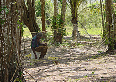
A reticent caretaker watches over Chau Hiix Cut limestone blocks are encased in roots
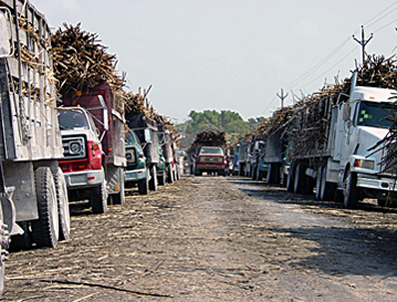
Orange Walk is a center of sugarcane processing The rare sight of Mennonites using motorized power
Belizeans are a mix of ethnicities. Almost half are Mestizo, nearly a third are Creole, and about ten percent are Ketchi or Mopan or Yucatec Maya. The remainder of the population is made up of Garífuna, East Indians and a bouquet of other nationalities. Mennonites began arriving in the late 1950s and are clustered in six main communities, farming and crafting fine furniture. Easily spotted by their clothing - women in bonnets and long dresses, men in denim overalls and hats - they operate their own schools, churches and banks. Passing their horse-drawn buggies in our air conditioned van, I wonder how they ever acclimated their apparel to this humid tropical climate.
Our next destination lay about twelve miles due west of Crooked Tree Village, but to reach it we had to drive 35 miles north to Orange Walk. Situated on the New River, this is a major center for processing sugarcane. The cane-laden trucks lined both sides of the road for miles, waiting to get into the mill. In Orange Walk we boarded a boat for the 20-mile journey south on the winding New River, past the Mennonite community of Shipyard, to Lamanai (lah-ma-NAHEE), a major ceremonial site for the ancient Maya.
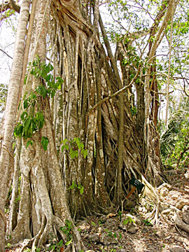
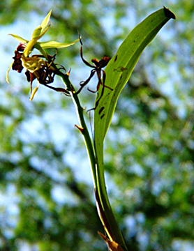
Strangler Figs eventually engulf their host Black Orchids are the National Flower of Belize Cohune nut oil is similar to coconut oil
At last the river opens into a Lagoon of the same name, and the first of Lamanai’s pyramids appears to float above the rainforest canopy. Following the path which traces the shoreline, huge Guanacaste, rubber and mahogany trees tower overhead. Parasitic strangler figs and black orchids affix themselves to breadnut trees and cohune palms. Crushed allspice leaves underfoot emit a sweet pungency into the tropical surroundings.
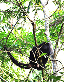
Five groups of howler monkeys make their home in the vegetation that encroaches upon the site, while numerous species of water birds live in the marshlands around the lagoon. A regional center that flourished due to its location on a major trade route, Lamanai was continuously occupied from 1500 BCE to 1675 CE. While much of the site has been left unexcavated and unrestored, easy paths lead to many of the immense structures.
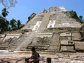
Low sloped walls and massive flat, oval stone markers Structure N10-43, tallest edifice at 108 feet, was built into in the playing field are unusual in Maya ballcourts a hillside overlooking the river
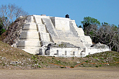
The 15-foot tall stone mask on Structure N9-56 is an often-used and recognizable symbol of Belize. Sadly, it is protected under a canopy of green-tinted fiberglass rather than native thatching, which casts an unnatural glow onto this masterpiece. Beneath the edifice you see today is a well-preserved temple dating from 100BCE, also decorated with stucco masks, an even earlier structure, and two tombs.
One of Belize's largest and most important sites, more than 720 structures have been identified. The location is also known as Indian Church due to the remains of two 16th century Christian churches and a 19th century British sugar mill a short distance away.
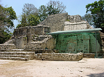
The carved mask on Structure N9-56 is an often-used Temple of the Jaguar Masks was built around 500 CE and recognizable symbol of Belize
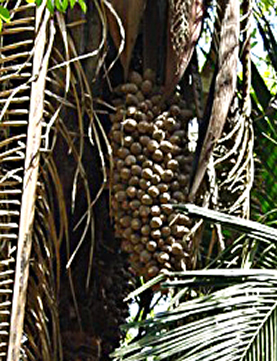
Spiny Lizards change color with the temperature Over 25 native species of palm produce a broad diversity of fruit
About twelve miles almost due east of Crooked Tree is the most extensively excavated of all sites in Belize, Altun Ha (ahl-TOON HAH). The 2.5 mile rock and dirt road leading into the site is lined with typical Creole villages and small stands selling a few handicrafts. Unfortunately, many of the excavated structures have been restored and white-washed to the point of losing much of their mystery and magic.
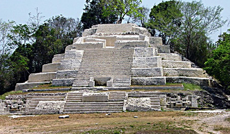
 Structure A3 rises in tiers with a broad stairway on the plaza side
A fairly extensive settlement by 200 BCE, Altun Ha was a vital trading link between the Caribbean and the interior, and its inhabitants grew wealthy. Stone causeways provided access across swampy areas to the east and north of the city. We don’t how large the city was, but about 500 constructions have been found and about one square mile excavated.
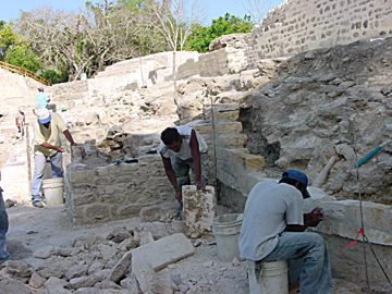
Structure B4, at 58.5 feet, is the tallest and best preserved at Altun Ha Workers restore Structure B3, a low platform with remains of rooms on top
Belize is a captivating country to visit, a treasure chest of marvels both natural and man-made. Although part of Central America, it has little in common with its Latin American neighbors. It is a member of the British Commonwealth, politically stable and governed by a parliamentary democracy. The mixture of racial and religious backgrounds meld into a agreeable blend of harmony and tolerance other countries should envy.
