Bighorn sheep, a soothing hot springs, wide-open vistas and, just as its name
implies, pronghorn antelope. Every season is good at the Hart Mountain National
Antelope Refuge in southeastern Oregon, but fall is when the refuge comes alive,
when the heart of Hart beats most resoundingly.
 |
||
|
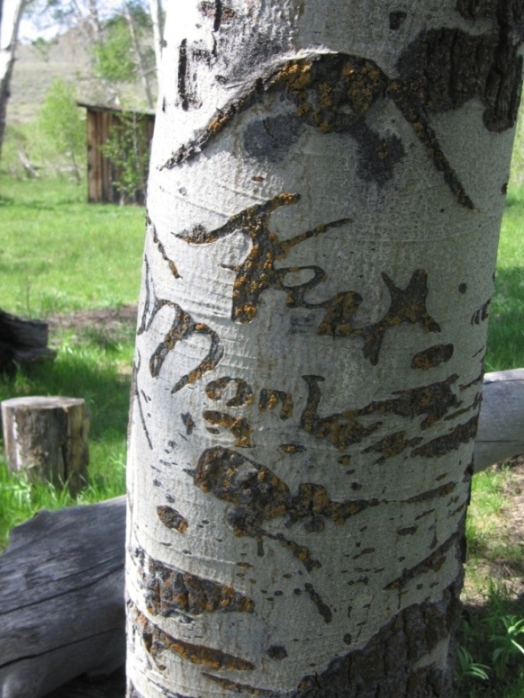
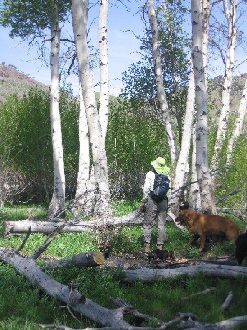
Can you read the arborglyph in the aspen?
|
I’ve been visiting Hart Mountain for 30 years, and it remains a thrill.
All of the roads are unpaved, and many traveled only by high clearance, 4-wheel
drive vehicles. The 278,000-acre refuge has few “trails.” The vast
majority are routes, some as steep as elevator shafts that descend or ascend
canyons carved on the western front, while others are basically cross-country
treks across vast expanses of sagebrush and junipers. With a variety of friends
and family and park staff, I’ve scrambled up and down Hart and DeGarmo
canyons, ambled and rode horseback along Poker Jim Ridge, and weaved through
aspen-lined thickets along Rock and other lesser creeks.
 |
 |
|
|
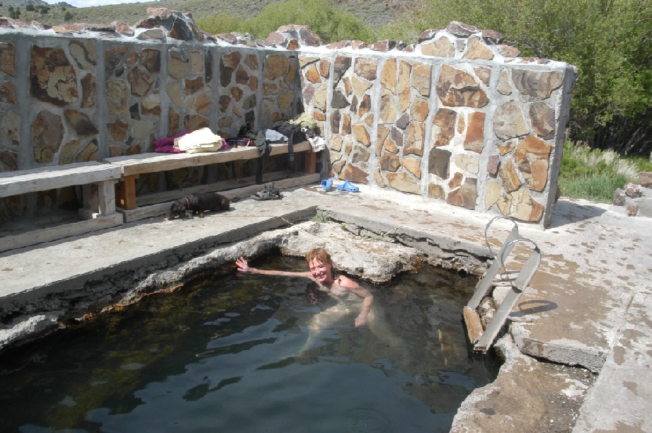
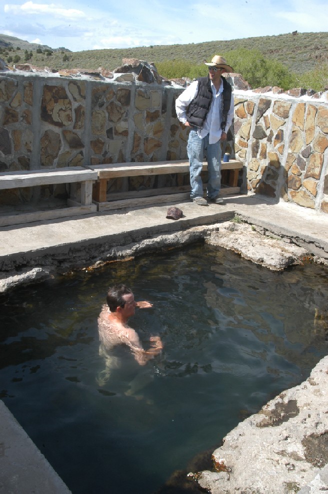
Soaking at the Hart Mountain hot springs bathhouse
|
Go ahead, jump in...
|
Hart Mountain is a place to explore, whether on foot, mountain bike or horseback.
Most visitors concentrate at the Hot Springs Campground, and for good reason.
A rock wall shields a 10- by 15-foot hot spring, where the bubbling water generally
ranges from about 100 to 105 degrees. It’s just a short walk from primitive
campsites mostly scattered along Rock Creek. It’s from the campground that
a rumpy, rocky road that’s easier hiked than driven provides access to
some of the refuge’s rugged but most delightful High Desert terrain. It’s
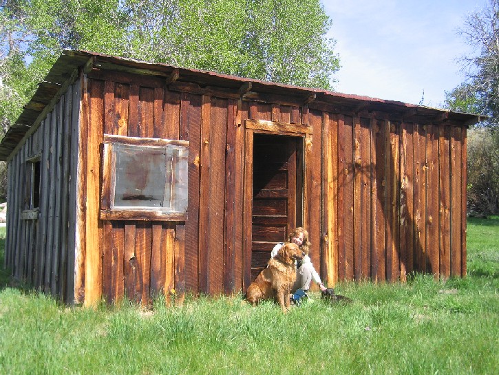
slightly more than 2 miles by the road, or Rock Creek, to the Barnhardi Cabin,
a falling apart plank shack that recalls times when sheep and, later, cattle,
grazed the refuge’s vast expanses. Cattle grazing was eliminated in the
1990s. From there it’s possible to forge on the Warner Peak. At an elevation
of 8,017-feet it’s the tallest point in the refuge, with views 2,300 feet
below toward the campgrounds and refuge headquarters and to the west more than
4,000 feet to the neighboring Warner Valley.
 |
||
|
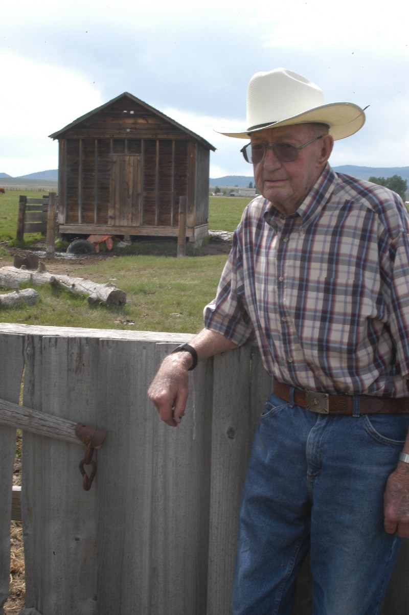
Remembering days past at the Barnhardi Cabin
|
Hiking along the ridge back toward the campground I’ve come face-to-face with curious buck antelope, and dipping down into Hart, Potter and DeGarmo canyons I’ve been nearly trampled by suddenly flushed mule deer and, one memorable time, bighorn sheep.
Wildlife and birds are among the attractions. With its diverse terrain, the
refuge is home to more than 300 species of wildlife. Along with the featured
pronghorn antelope – and it’s almost impossible to not see dozens
in even a quick pass-through visit – the refuge provides habitat for more
than 40 species of mammals, including California bighorn sheep, coyotes, deer
and rabbits, along with about 240 bird species, including sage grouse, best
seen in the spring mating season.
 |
 |
|
|
Hiking along groves of aspens
|
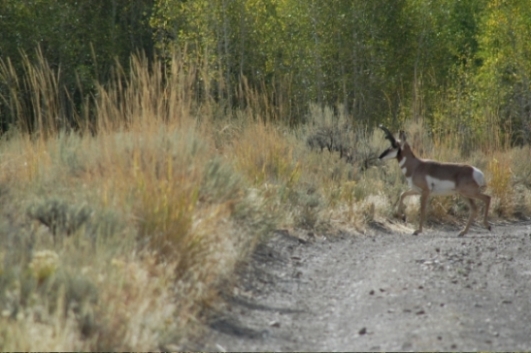
Pronghorn antelope give the refuge its name
|
But we’re talking fall, the season when nighttime temperatures routinely dip below freezing and groves of aspens turn brilliant hues of reds and yellows. One morning the creek behind my tent was frozen so solidly I needed an ax to get water. Another day, resting in my sleeping bag, I was stunned to hear a steady rain, and laughed at myself when a peek outside the tent revealed the “rain” was actually the sound of crisp aspen leaves falling from the trees. On fall nights, while soaking in the hot spring, I’ve listened to yipping coyotes and, as the wind whistled past, sat back as clouds seemed to race across the sky. One night, walking back to camp from the hot spring, a noiseless owl swooped just over my border collie, Libby. Just as quietly and quickly as it appeared, it quit its descent and swooped back into the trees, waiting for smaller pickings.
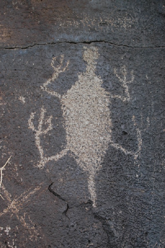
One early fall late afternoon a friend and I drove and walked to Petroglyph
Lake. The name comes from petroglyphs, symbols and images painted on cliff faces
by generations-ago prehistoric Indians. The images are varied and indistinct,
and what they represent is subject to speculation. That’s part of the pleasure.
Some are geometric patterns, while others are zoomorphic, or in the forms of
animal-like images. One appears to be a giant bug, while another is distinctly
horse-shaped. Some are human images, including one human body with a weird bug-like
head.
 |
 |
|
|
What are they?
|
Petroglyphs leave it open to a viewer’s imagination
|
On one memorable visit, friends and I sat tucked under the painted rocks while, on the opposite side of the lake, individual pronghorn rams guided groups of about 20 ewes and lambs to water. They stood guard then escorting their charges back upslope while another ram led another group to water. But the magic didn’t end there. As the setting sun cast a crimson glow, the rocks above rattled and clattered, like the sound of a fleet of pickup trucks. Only they weren’t trucks. Minutes later the first of a series of bighorn rams gingerly followed a rocky path from the rocks behind us to the lake, where he lapped a long drink before retracing his steps. Over the next half-hour, a series of wary rams followed one at a time.
Fall is a season I’ve spent hours sleuthing along canyons, Poker Jim and ridge tops in search of bighorn sheep. It’s not unusual to make the best sighting about sunset from the main road that connects the refuge with Plush. One evening, after spying more than 20 bighorns, I parked my car, snuck up a side canyon and climbed to the top of the rocks. I waited, but never saw a single sheep. Disappointed, I hiked back to my car. It was surrounded by curious bighorns.
There are many ways to make your own kind of magic at Hart Mountain.
 |
 |
|
|
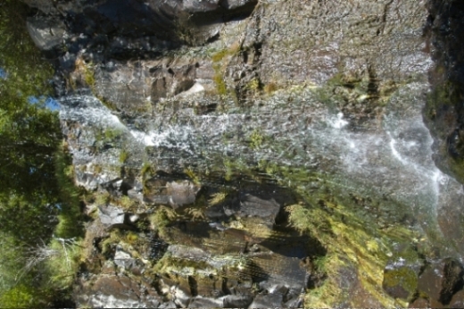
The DeGarmo waterfall
|
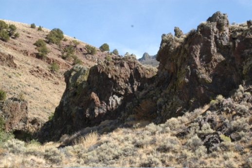
The view out DeGarmo Canyon
|
When You Go
The Hart Mountain National Antelope Refuge is 65 miles east of Lakeview, the
nearest major town. Take Highway 395 north for about 5 miles, then go right
(east) on Highway 140, left at a well-marked intersection 19 miles from the
intersection and another 19 miles to Plush, the last community with gasoline
and basic groceries. Several miles after Plush – follow the signs - the
paved road gives way to an improved gravel road the final 36 miles to the refuge
headquarters, where an office with information, restrooms and water is open
24 hours a day. The road up the steep grade offers spectacular views of the
Warner Valley. Consider stopping at a well-marked pullout and taking a short
trail to a dramatic valley overlook.
Camping is available at the former CCC (Civilian Conservation Camp) at the base of the mountain, and is especially recommended for people towing trailers or with large RVs, and at the Hot Springs Campground 5 miles from the headquarters. There are no facilities on the refuge for gas, groceries or other supplies, so go prepared.
For information call the Sheldon-Hart National Wildlife Refuge headquarters at (541) 947-3315 or visit the refuge Web site at www.fws.gov/sheldonhartmtn/Hart. Another good source is through the Friends of Hart Mountain, a non-profit volunteer managed group that supports the refuge and sells T-shirts, hats, coffee mugs to help sponsor programs. To learn more, visit www.freewebs.com/friendsofhartmountain/ Before hiking, check with refuge staff on possible routes or follow suggestions in “100 Hikes/Travel Guide Eastern Oregon” by William Sullivan. To reach the DeGarmo Canyon waterfall, carefully follow Sullivan’s directions.
* * *
Lee Juillerat is the regional editor for the Klamath Falls Herald and News,
author or co-author of books about Crater Lake National Park, and frequent contributor
to a variety of magazines, including Northwest Travel, Oregon Coast, Range and
Horizon and Alaska airlines inflight publications. He can be reached at lee337@cvc.net